How it all started 
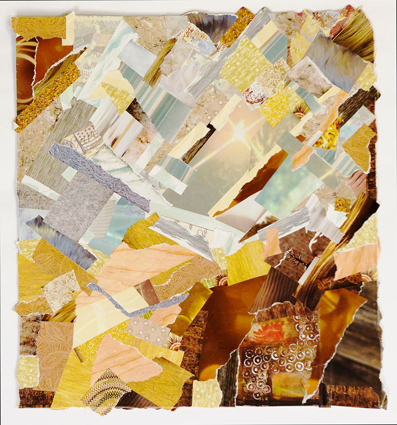
In October 2014, a co-worker friend forwarded an email to me by mistake (or was it?). It was announcing a call for proposals of public outreach projects combining art and science for which there were funds available. She quickly asked me to disregard the email as she had meant to forward it to herself. Moments later, she emailed back and asked if I would be interested in joining her in submitting a proposal. She and I often share our progress on different creative projects, so this opportunity seemed like a good one for us to collaborate on. Well, I am not a ‘joiner’ and usually don’t participate in public events – but on thinking more about her plan to use the remote sensing images from the US Geological Survey’s ‘Earth as Art‘ as inspiration, the ideas starting sparking and then really caught fire. Knowing that my friend would take the lead in the administrative part of the proposal, I figured ‘oh, why not?’ and our project was launched. We decided to host an art show in which any of our colleagues could participate by sharing their interpretations of the images. Lo and behold, our proposal actually got funded, so now we had to deliver (yikes)! My friend made an absolutely beautiful mosaic of an Alaska river system and I took my collage-making hobby from randomly ‘playing with color’ to actually playing with a purpose. Our art show, ‘The Masterpiece Called Earth’, was one of several ‘First Friday’ art events held in town and included 9 artists, several of whom didn’t even consider themselves artists. It was a great success! This experience nudged me out of my comfort zone, encouraged me to share my artwork more publicly and set me on my current path.
Okavango Delta
Botswana Southern
Africa’s Okavango River spreads across the landscape of northern Botswana to become the lush Okavango Delta seen in this Landsat 5 image from 2009. The Okavango Delta is one of the world’s largest inland water systems, draining an area that ranges from 9,000 square kilometers (May–October) to 16,000 square kilometers (November–April).
Von Kármán Vortices
Southern Pacific Ocean
Swirling clouds line up in a formation known as a von Kármán street. This phenomenon is named after aerodynamicist Theodore von Kármán, who derived the theoretical conditions under which it occurs (von Kármán was one of the principal founders of NASA’s Jet Propulsion Laboratory).
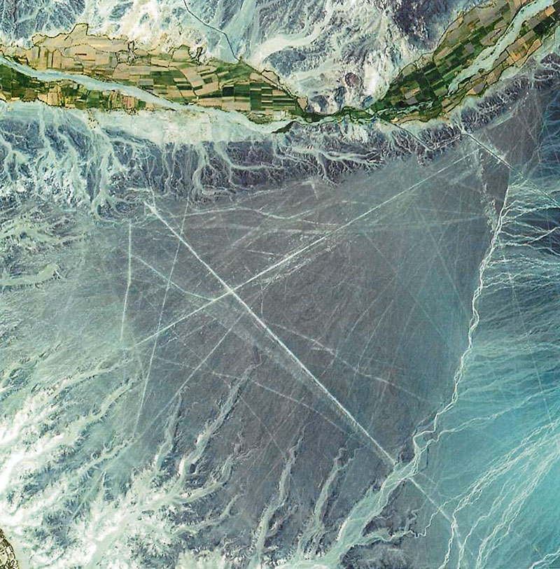
Nazca Lines
Peru
The Nazca Lines are a series of ancient geoglyphs located in the Ica Region in southern Peru. Estimated to be created by the Nazca culture between 400 and 650 C.E., the Nazca Lines were made by removing reddish iron-oxide pebbles that cover the surface of the desert. When the gravel is removed, the lines contrast with the light color underneath.The Nazca Lines were designated a UNESCO World Heritage Site in 1994.
Mayn River
Russia
The Mayn River is featured in this 2000 Landsat 7 image with what may be a portion of the Anadyr River. The Mayn is a tributary of the Anadyr, flowing roughly northwards from its source in the Koryak Mountain Range through the far northeastern corner of Siberia and the forest-tundra subzones of the Chukotka Peninsula. While these rivers are frozen for about 8 to 9 months in a year, they are home to chum and sockeye salmon during the summer months.
Kamchatka Peninsula
Russia
The eastern side of Russia’s Kamchatka Peninsula juts into the Bering Sea west of Alaska. The terrain, which has been shaped by glaciers, appears covered in white snow in this 2002 winter image from Terra. Glacial cirques and moraines stand out clearly underneath the snow cover. The dark ocean is ice-free near the coast. Farther out to sea, drift ice, pack ice, and pancake ice are visible in blue and blue-gray colors.
Kalahari Desert
Southern Africa
Derived from a Tswana word meaning “waterless place,” the Kalahari Desert is a large stretch of semiarid, sandy savannah that covers part of Botswana, Namibia, and South Africa. In this Landsat 7 image from 2000, the Nossob River cuts through colorful streaks of sand deposits.
Belcher Islands
Canada
The Belcher Islands are spread across some 13,000 square kilometers in southeastern Hudson Bay, but within that area, only about 3,000 square kilometers are actual islands and dry land. Landsat 7 captured this image of the archipelago in August 2000, when the north’s brief summer was coming to an end.
Dardzha Peninsula
Turkmenistan
Jutting into the Caspian Sea, the Dardzha Peninsula in western Turkmenistan lies among the shallow, coastal terraces in the sea’s southeast portion. Strong winds create huge sand dunes near the water, some of which are partly submerged. Farther inland, the dunes transition into the low sand plains of the Karakum Desert, which covers 70 percent of the country. Landsat 7 captured this image in 2001.
Algerian Desert
Algeria
Lying amid the Great Eastern Erg, the Great Western Erg, and the Atlas Mountains in Northern Africa, the Sahara Desert in central Algeria is dotted by fragmented mountains (in brown, lower right) where barren, windswept ridges overlook arid plains. In this Landsat 5 image from 2009, a system of dry streambeds crisscrosses the rocky landscape awaiting the rare, intense rains that often cause flash floods.